Divided Range: How America's Highway System Functions as a Continental-Scale Wildlife Barrier
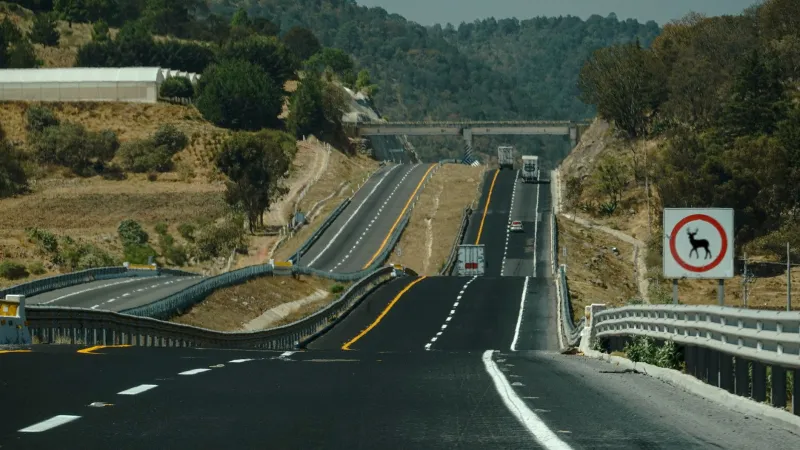
The United States maintains more than four million miles of roads. That figure is familiar enough to register as infrastructure rather than ecology — a background feature of a developed nation rather than a variable in population biology. But for a mountain lion attempting to move between the Santa Ana Mountains and the San Gabriel range in Southern California, or a grizzly bear navigating the fragmented terrain south of Glacier National Park, the road network is not background. It is a defining constraint on survival, reproduction, and genetic continuity. GIS science is now providing the tools to understand that constraint in precise spatial terms — and to begin designing solutions at the scale the problem demands.
Mapping the Barrier Effect
The ecological consequences of roads have been studied at the site level for decades. What spatial science adds is the capacity to understand those consequences at landscape and continental scales — to see not just where a particular highway presents a crossing hazard, but how the cumulative geometry of the road network partitions species ranges into isolated fragments across entire regions.
Researchers working with geospatial datasets have developed road effect zone models that estimate the spatial extent of road influence on wildlife populations. These models integrate traffic volume data, road surface type, noise propagation estimates, and species-specific behavioral thresholds to produce maps showing not simply where roads exist, but how far their effects reach into surrounding habitat. When those maps are overlaid against species range data and movement corridors identified through GPS telemetry studies, the result is a picture of remarkable fragmentation — one in which nominally continuous habitat is revealed to be a mosaic of effectively isolated patches separated by corridors of infrastructure.
For large mammals, the implications are particularly acute. Species such as pronghorn, black bear, elk, and mule deer require large home ranges and seasonal movement corridors that routinely intersect with major highways. GIS analysis of highway placement relative to mapped migration routes reveals that many of the nation's most heavily trafficked roads were constructed directly across movement paths that predate European settlement — routes shaped by topography, vegetation, and water availability over thousands of years. The highways did not redirect those movements. They blocked them.
The Genetics of Isolation
The barrier effect of roads is not merely a behavioral phenomenon. Its consequences extend into the genetic architecture of wildlife populations in ways that spatial science is now able to trace with considerable precision. Landscape genetics — a discipline that combines spatial analysis with population genomic data — has demonstrated that genetic differentiation between mammal populations is strongly correlated with the road infrastructure separating them.
Studies of mountain lion populations in California have produced some of the most compelling evidence. Genetic sampling combined with GIS mapping of highway locations revealed that Interstate 10 and Highway 101 function as near-absolute barriers to gene flow between lion populations in adjacent mountain ranges. Individuals from populations separated by these roads show levels of genetic differentiation that would normally be expected between populations separated by hundreds of miles of unsuitable habitat — not the few miles of pavement that actually divide them. The genetic consequences of that isolation are not abstract. Reduced heterozygosity, elevated inbreeding coefficients, and the loss of adaptive variation are measurable outcomes with direct implications for population viability under environmental stress.
Similar patterns have been documented in wolverine populations in the northern Rockies, black-footed ferret reintroduction zones, and pronghorn herds in Wyoming's Upper Green River Basin, where a combination of fencing and road infrastructure has compressed historical migration corridors to a fraction of their original width. In each case, spatial analysis provides the framework for understanding not just that fragmentation is occurring, but precisely where, between which populations, and through which specific infrastructure features.
Crossing the Divide: Where GIS Guides Infrastructure Solutions
The spatial clarity that GIS provides is not merely diagnostic. It is directional — capable of identifying where targeted infrastructure interventions would generate the greatest conservation return.
Wildlife crossing structures, including overpasses vegetated to blend with surrounding habitat and underpasses scaled to accommodate large ungulates and carnivores, have demonstrated effectiveness in restoring movement connectivity across highway barriers. The challenge has historically been determining where to build them. Road networks are long. Conservation budgets are not. Spatial prioritization is essential.
GIS-based crossing placement models integrate multiple data layers to identify optimal crossing locations: species movement data from GPS-collared individuals, genetic connectivity analysis identifying the specific gaps in gene flow most urgently requiring bridging, road mortality hotspot mapping derived from wildlife-vehicle collision records, and terrain analysis identifying natural topographic funnels that concentrate animal movement. The synthesis of these layers produces ranked prioritization maps that allow transportation agencies and conservation organizations to direct limited resources toward the crossings most likely to restore meaningful connectivity.
In Montana, spatial analysis guided the placement of crossing structures along Highway 93 through the Flathead Indian Reservation, a project developed in collaboration with the Confederated Salish and Kootenai Tribes. Monitoring data collected after installation confirmed substantial increases in crossing rates by deer, elk, bear, and other species — validating the spatial model's predictions and demonstrating that GIS-informed crossing design can deliver measurable ecological outcomes.
In Wyoming, conservation organizations used movement corridor mapping to successfully advocate for crossing infrastructure along Highway 191 in the Pinedale region, where the compression of the pronghorn migration corridor had become a documented population bottleneck. The spatial evidence provided the technical foundation for a policy conversation that might otherwise have remained qualitative.
Scaling the Solution
The scale of road-driven fragmentation in the United States is substantial enough that no single crossing project or regional initiative will resolve it. What spatial science offers is the capacity to think about the problem — and its solutions — at an appropriate continental scale.
National-level analyses using road density mapping, species range data, and genetic sampling networks have identified regions where road fragmentation poses the highest near-term risk to mammal population viability. The greater Yellowstone ecosystem, the Sky Islands region of the Southwest, the Appalachian corridor from Georgia to Maine, and the Pacific Coast ranges all emerge as areas where the spatial configuration of road infrastructure intersects with species vulnerability in ways that demand strategic attention.
The Federal Highway Administration's Wildlife Crossing Pilot Program, established through the Infrastructure Investment and Jobs Act of 2021, represents a meaningful policy acknowledgment of this challenge. GIS science has a direct role to play in ensuring that the resources allocated through that program are directed by rigorous spatial analysis rather than political convenience or anecdote.
America's road network was built to move people and goods efficiently across a continent. That purpose remains valid. What spatial science now makes possible is designing and retrofitting that network with sufficient ecological intelligence to ensure it does not simultaneously serve as a mechanism for the slow genetic unraveling of the wildlife populations that share this landscape. The maps to guide that work already exist. The scientific case is established. What remains is the institutional will to act on what the data shows.