Drained Without a Record: The Millions of Wetland Acres America's Monitoring Systems Cannot See
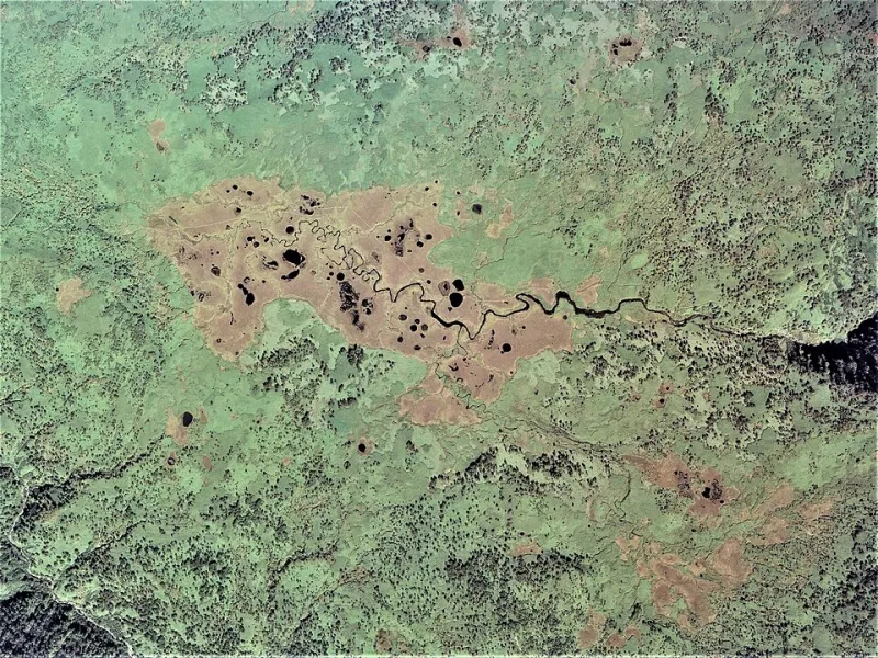
Photo: 国土地理院, Attribution, via Wikimedia Commons
Wetlands are among the most ecologically productive landscapes on Earth. They filter drinking water, buffer coastal communities against storm surge, store disproportionate quantities of carbon, and sustain biodiversity that healthy upland systems alone cannot support. Federal law, through the Clean Water Act and related statutes, nominally protects these landscapes. Yet a close examination of available spatial data reveals a troubling reality: a substantial portion of American wetland loss is occurring in regulatory and cartographic blind spots that existing monitoring frameworks are structurally unable to illuminate.
The question is not simply whether wetlands are disappearing. They demonstrably are. The more pressing scientific and policy question is how much conversion is happening without triggering federal review—and whether America's current spatial monitoring infrastructure is even capable of answering that question accurately.
The Map Is Not the Wetland
The National Wetlands Inventory (NWI), administered by the U.S. Fish and Wildlife Service, remains the foundational spatial dataset for wetland tracking in the United States. It is also, in critical respects, outdated. Large portions of the NWI rely on imagery and field surveys conducted decades ago, before the widespread adoption of high-resolution multispectral satellite analysis, LiDAR-based elevation modeling, or synthetic aperture radar capable of detecting seasonal inundation beneath dense canopy.
What this means in practical terms is that the official record of where wetlands exist—and where they have been lost—is incomplete by design. A landowner draining a seasonally saturated prairie pothole in the Upper Midwest, or converting a forested bottomland in the Mississippi Delta, may be operating in an area where the NWI either misclassifies the land type or contains no current data at all. Without an accurate baseline map, there is no mechanism for detecting change.
Comparative analysis between NWI layers and more recent multispectral datasets—including Sentinel-2 and Landsat 8 time-series composites processed through vegetation index and water occurrence algorithms—reveals persistent discrepancies. In agricultural counties across Iowa, Illinois, and Minnesota, areas exhibiting hydrological signatures consistent with wetland function appear in recent satellite-derived products but carry no wetland designation in federal inventory data. These are not marginal edge cases. In some counties, the spatial divergence between NWI coverage and remotely sensed hydrological indicators spans thousands of acres.
Jurisdictional Fractures and the Enforcement Gap
The 2023 Supreme Court decision in Sackett v. EPA dramatically narrowed the definition of waters protected under the Clean Water Act, removing federal jurisdiction over wetlands that lack a continuous surface connection to navigable waters. From a conservation science standpoint, the ecological significance of a wetland is entirely independent of its hydrological connectivity to a navigable channel. From a regulatory standpoint, however, that distinction now determines whether any federal review occurs at all.
Geospatial analysis of affected wetland types illustrates the scope of this jurisdictional contraction. Isolated prairie potholes—which collectively provide nesting habitat for a significant share of North America's migratory waterfowl—frequently lack the continuous surface connections that post-Sackett federal jurisdiction requires. Vernal pools in California's Central Valley, playa lakes across the Southern High Plains, and depressional wetlands throughout the Southeast similarly fall outside the revised regulatory perimeter in many instances.
When federal jurisdiction does not attach, enforcement responsibility defaults to state programs that vary enormously in capacity, funding, and political will. Several states maintain no meaningful wetland protection programs beyond federal requirements. In those states, the jurisdictional gap created by narrowed federal definitions translates directly into an enforcement vacuum.
Quantifying What Cannot Be Seen
Estimating the scale of unrecorded wetland conversion requires methodological care. Direct measurement is impossible where baseline data is absent. However, indirect spatial approaches offer partial but meaningful insight.
One approach cross-references agricultural drainage permit records—maintained by county drainage districts across the Midwest—with NWI wetland boundaries and USDA Cropland Data Layer classifications. Where drainage infrastructure has been permitted and cropland has expanded into areas with prior wetland hydrology signatures, conversion can be inferred even without direct field verification. Preliminary analysis using this methodology in selected Midwest counties suggests that permitted drainage activity has affected areas well beyond what NWI change data would indicate.
A second approach applies machine learning classification to multi-year Sentinel-2 imagery stacks to identify areas that exhibited seasonal inundation patterns consistent with wetland hydrology in earlier years but no longer do. This method, increasingly refined in peer-reviewed remote sensing literature, can detect hydrological change at sub-field scales across large geographic extents. Applied to agricultural regions of the Midwest and Southeast, it identifies areas of probable wetland conversion that appear nowhere in federal regulatory records.
The ecosystem services implications are substantial. Studies published in peer-reviewed hydrology and ecology journals have estimated the annual value of wetland services—flood attenuation, water quality improvement, carbon sequestration, and wildlife support—at thousands of dollars per acre. Unrecorded conversions affecting millions of acres represent a fiscal loss to the public that is never formally acknowledged because the underlying spatial record does not capture the transition.
The Case for Integrated Spatial Monitoring
The scientific tools necessary to close these monitoring gaps exist. High-resolution, cloud-penetrating synthetic aperture radar can detect surface water and soil moisture conditions that optical sensors miss. LiDAR-derived digital elevation models can identify microtopographic depressions that concentrate water and support wetland function even in landscapes that appear uniformly upland on conventional maps. Time-series analysis of multispectral imagery can document hydrological change at the parcel scale across continental extents.
What is absent is not technical capacity but institutional commitment to deploying these tools within a unified, continuously updated national monitoring framework. The NWI update cycle remains slow and geographically uneven. State-level data sharing with federal systems is inconsistent. There is no operational platform that integrates remote sensing change detection with regulatory review triggers in real time.
Building such a system would require federal investment in data infrastructure, interagency coordination protocols, and standardized classification methodologies. It would also require political acknowledgment that the current spatial monitoring apparatus is inadequate to the conservation challenges American wetlands face.
What the Data Demands
Conservation science is, at its foundation, a discipline of measurement. Effective protection of any natural system requires accurate knowledge of where that system exists, how it is changing, and what forces are driving that change. For American wetlands, the honest assessment is that the national monitoring framework does not currently provide that knowledge at the resolution or currency the problem demands.
The phantom acres of converted wetlands—drained, filled, or hydrologically severed without entering the regulatory record—represent both an ecological loss and an informational failure. Addressing the latter will not automatically prevent the former, but it is a necessary precondition for any serious effort to do so. Until the maps reflect reality, the protections built on those maps will remain structurally incomplete.