Invisible Depletion: Why America's Groundwater Crisis Stays Hidden Without Unified Spatial Monitoring
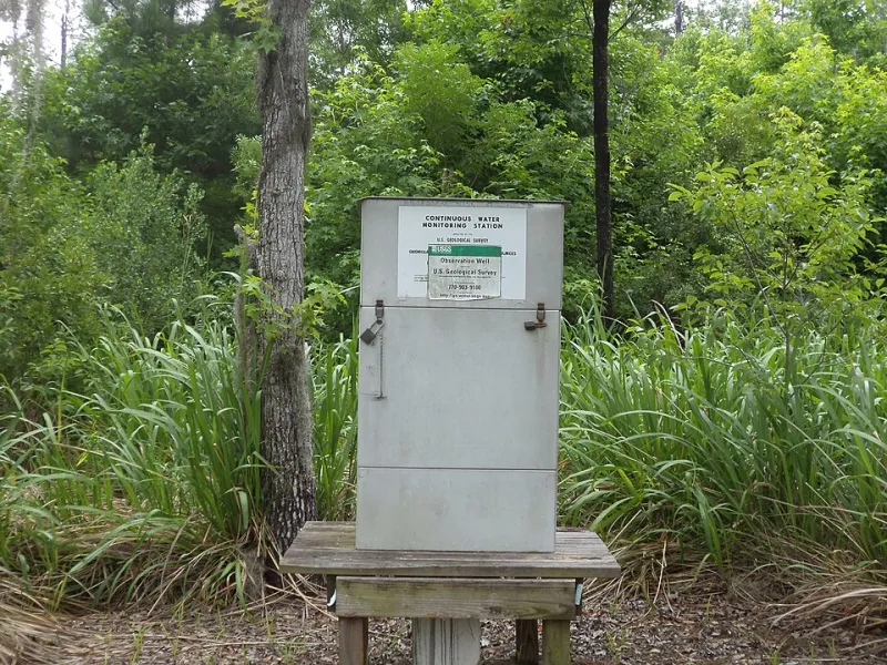
Photo: Michael Rivera, CC BY-SA 3.0, via Wikimedia Commons
Beneath the surface of America's most productive agricultural regions, a slow-motion catastrophe is unfolding largely outside the reach of public awareness. Aquifers that took thousands of years to fill are being drawn down at rates that outpace natural recharge by orders of magnitude. Yet the monitoring infrastructure meant to track this loss remains deeply inconsistent, jurisdictionally fragmented, and in many areas, geospatially blind. The consequence is not merely a data problem—it is a resource management failure with cascading implications for agriculture, municipal water supply, and long-term ecological stability.
The United States has no unified national framework for spatially mapping groundwater extraction. What exists instead is a patchwork of state-administered monitoring programs, each operating under different methodologies, reporting intervals, and spatial resolutions. Some states maintain dense networks of observation wells with regular data submissions to federal repositories. Others collect measurements sporadically, rely on self-reported extraction data from permit holders, or have simply never developed comprehensive monitoring programs at all. The result is a continental-scale map with enormous blank spaces where the most critical information should be.
The Geometry of a Data Gap
Geographic information systems are only as powerful as the data they are given to work with. When hydrological scientists attempt to construct regional or national models of aquifer health, they are forced to work around these monitoring voids—interpolating conditions across counties and watersheds where no verified measurement points exist. In practice, this means that depletion events may be occurring well below the detection threshold of existing systems, advancing unobserved until they manifest as well failures, land subsidence, or sudden drops in agricultural productivity.
The spatial dimension of this problem is not incidental. Aquifer systems do not respect political boundaries. The Ogallala Aquifer, which underlies portions of eight Great Plains states from South Dakota to Texas, is perhaps the most documented example of a transboundary system subject to radically inconsistent monitoring standards. Kansas and Nebraska have invested significantly in observation well infrastructure and spatial data integration. Portions of Texas and Oklahoma, by contrast, contain large monitoring gaps where extraction rates are estimated rather than measured. When researchers attempt to model the Ogallala's overall depletion trajectory, those gaps introduce substantial uncertainty into projections that inform irrigation policy across the entire region.
The Ogallala is not unique in this regard. The Central Valley aquifer system in California, the Mississippi Embayment aquifer in the mid-South, and numerous smaller regional systems all exhibit similar patterns of spatially uneven observation. The regions with the least monitoring infrastructure are frequently those experiencing the most intensive extraction pressure—a pattern that inverts the logic of precautionary resource management.
Why States Resist Standardization
The absence of a unified spatial monitoring framework is not accidental. It reflects a set of entrenched political and economic dynamics that have resisted federal coordination efforts for decades. Groundwater law in the United States is governed almost entirely at the state level, and in many western and plains states, the doctrine of prior appropriation assigns water rights as property interests that predate modern environmental regulation. Mandatory reporting requirements and third-party monitoring are frequently characterized by agricultural interests as regulatory overreach that threatens established rights.
There is also a more straightforward political calculus at work. Comprehensive spatial monitoring of groundwater extraction has the potential to document, with uncomfortable precision, the degree to which current usage patterns are unsustainable. For states whose economies are heavily dependent on irrigated agriculture, transparent depletion data creates pressure for restrictions that elected officials may prefer to defer. The absence of data, in this context, is not a neutral condition—it is a policy choice with identifiable beneficiaries.
Federal agencies including the United States Geological Survey have developed voluntary frameworks for interstate groundwater data sharing, and the National Integrated Drought Information System incorporates some groundwater metrics into its assessments. But voluntary participation leaves the largest monitoring gaps precisely where political resistance is strongest.
What Spatial Integration Could Reveal
The scientific case for standardized GIS-based groundwater monitoring is not theoretical. Pilot programs and academic research initiatives have demonstrated what becomes visible when spatial data is properly integrated across jurisdictional lines.
In the southern High Plains, researchers combining satellite-based gravity measurements from NASA's GRACE mission with local well data have produced depletion maps that reveal spatial patterns invisible to any single monitoring network. These analyses have identified localized zones of accelerated decline—often corresponding to high-density irrigation districts—that would not have been detected through conventional point-based monitoring alone. The same approach applied systematically across the Central Valley has helped California water managers identify subsidence hotspots and prioritize recharge investment in ways that state-level data alone could not support.
Remote sensing technologies, including synthetic aperture radar for subsidence detection and multispectral analysis for vegetation stress as a proxy indicator of water table decline, offer additional observational layers that can partially compensate for gaps in ground-based monitoring networks. These tools are most effective, however, when integrated within a coherent spatial framework that allows comparison across time and geography. Without that framework, the satellite data remains a collection of isolated observations rather than a diagnostic system.
The technology to build that framework exists. The scientific methodology to interpret its outputs is well established. What is lacking is the political architecture to mandate participation and the institutional will to treat groundwater as a spatially managed common resource rather than a private extraction opportunity.
The Cost of Continued Inaction
The consequences of maintaining the status quo are not abstract. Agricultural communities in the Texas Panhandle and southwestern Kansas are already confronting well failures and declining irrigation capacity as the Ogallala's saturated thickness diminishes in areas where it was once hundreds of feet deep. Municipal water systems in smaller plains communities are facing supply constraints that will require expensive infrastructure responses within the planning horizons of currently operating facilities.
These outcomes are not unforeseeable. They are, in important respects, the predictable result of managing a finite resource without the spatial intelligence needed to understand its rate of loss. The monitoring gaps that currently obscure depletion rates are not technical limitations—they are governance failures that geospatial science has the capacity to address.
The question facing water managers, state legislators, and federal policymakers is whether the political will to close those gaps can be assembled before the aquifers themselves reach a point of no return. For some regions, the window for meaningful intervention is already narrowing. For others, the data to know where that threshold lies simply does not yet exist—which may itself be the most consequential finding that unified spatial monitoring could deliver.