Charged and Unchecked: What GIS Mapping Reveals About the Environmental Blind Spots in America's EV Infrastructure Boom
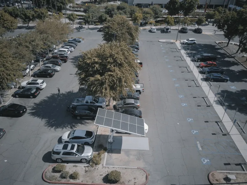
The pivot toward electric vehicles has been framed, almost universally, as an environmental success story. Fewer tailpipe emissions, reduced dependence on fossil fuels, a measurable contribution to slowing climate change—the case is well established. What has received far less attention is the physical geography of the infrastructure required to make electrified transportation function at scale. Charging stations do not materialize from policy alone. They require land, impervious surface, utility connections, drainage systems, and access corridors. At the level of a single station, the footprint is modest. At the scale of a continental buildout, the cumulative picture warrants serious examination.
Geospatial analysis is beginning to fill that gap—and the findings raise questions that neither the transportation sector nor federal infrastructure planners appear fully prepared to answer.
A Network Built Without a Map
As of 2024, the United States hosts more than 60,000 public EV charging locations, a number that federal investment through the Bipartisan Infrastructure Law is projected to multiply several times over in the coming decade. The National Electric Vehicle Infrastructure Formula Program alone is directing $5 billion toward charging deployment along designated Alternative Fuel Corridors, with additional funding flowing through state-level programs and private sector expansion.
What is conspicuously absent from this investment framework is a standardized geographic screening process. Unlike utility-scale energy projects—which typically trigger environmental impact assessments under the National Environmental Policy Act—most individual charging installations fall beneath regulatory thresholds that would require formal habitat or watershed review. The result is a network assembled station by station, without any mechanism for evaluating the landscape-level pattern that emerges in aggregate.
When GIS analysts overlay the current and projected distribution of charging infrastructure against ecological databases—including the U.S. Fish and Wildlife Service's critical habitat designations, the National Wetlands Inventory, and regional wildlife corridor models—the spatial mismatches become visible in ways that project-level permitting cannot detect.
Where the Stations Are Going
Federal highway corridors are the primary spine of EV charging deployment, which is logical from a range-anxiety and user-demand perspective. Travelers need reliable access along long-distance routes, and Interstate rest areas, highway-adjacent commercial parcels, and truck stops represent low-friction siting opportunities. But those same corridors frequently trace the edges of ecologically significant landscapes.
In the Mountain West, Alternative Fuel Corridors designated along Interstate 80, US-191, and similar routes pass through or immediately adjacent to Greater Yellowstone Ecosystem connectivity zones, sagebrush steppe habitats supporting pronghorn migration, and river riparian systems that anchor regional biodiversity. In the Southeast, corridor designations along I-10 and I-75 intersect with longleaf pine restoration areas and wetland complexes that have been identified by conservation organizations as high-priority recovery landscapes.
GIS analysis of parcel-level siting data, cross-referenced with land cover classifications and proximity buffers around designated critical habitat, suggests that a meaningful share of new charging installations is occurring within distances that would, under different regulatory frameworks, trigger at minimum a preliminary ecological assessment. The precise percentage varies by region and by the buffer threshold applied, but in several corridor segments the overlap is substantial enough to warrant attention at the planning stage rather than after construction.
Impervious Surface and the Hydrology Problem
Beyond habitat proximity, the hydrological implications of charging infrastructure deserve closer scrutiny than they have received. Each charging station—particularly the DC fast-charging facilities that require larger footprints, canopy structures, and expanded parking areas—adds to the cumulative impervious surface load in its watershed. Stormwater runoff from paved charging areas carries not only conventional pollutants but also particulates associated with tire wear and, in some configurations, transformer fluids and electrical infrastructure compounds.
Watershed-scale GIS modeling, the same methodology applied to understanding the hydrological effects of suburban sprawl, can identify which charging corridor segments are adding impervious area within already-stressed subwatersheds. In regions where impervious cover already approaches or exceeds the thresholds associated with stream degradation—generally cited in the literature at around ten percent of watershed area—additional hardscaping from charging infrastructure represents a marginal impact with potentially nonmarginal consequences for aquatic species and downstream water quality.
The Chesapeake Bay watershed, parts of the Pacific Northwest's salmon-bearing river systems, and the Great Lakes basin all contain corridor segments where this calculation is worth performing before deployment decisions are finalized rather than afterward.
The Equity Dimension of Siting Patterns
Geospatial analysis of charging network distribution also surfaces a parallel concern: the infrastructure is not being built evenly, and the communities absorbing the greatest construction and operational impacts are not always the communities best positioned to benefit from EV adoption.
Charging installations in lower-income and rural communities—often sited at existing commercial facilities with limited site improvement resources—may receive less attention to drainage design, landscaping buffers, or light pollution mitigation than installations in higher-income suburban or urban contexts. Meanwhile, tribal lands and rural communities with limited regulatory capacity are, in some corridor segments, hosting infrastructure that passes through or near culturally significant landscapes without meaningful consultation.
This spatial inequity in both benefit distribution and impact absorption is not unique to EV infrastructure, but it is replicable at scale in ways that systematic geographic planning could mitigate.
What a Conservation-Informed Siting Framework Would Look Like
The tools to do this work exist. National databases covering wetlands, critical habitat, wildlife corridors, watershed impervious cover, and environmental justice indicators are publicly accessible and GIS-compatible. The Federal Highway Administration, the Department of Energy, and state transportation agencies could, in principle, require that charging infrastructure siting decisions under federal funding programs be screened against these layers before site selection is finalized.
Several conservation organizations have begun developing prototype screening tools modeled on the approach used for utility-scale solar and wind siting—projects where the regulatory environment has matured enough to incorporate landscape-level spatial review. Applying analogous logic to charging infrastructure would not halt deployment. It would redirect a share of installations away from the most ecologically sensitive locations and toward already-disturbed sites—parking structures, brownfields, commercial zones—where the marginal environmental cost is substantially lower.
The precedent for this kind of spatial intelligence informing infrastructure planning is well established in conservation science. What is missing is the institutional will to apply it to a sector that has, until recently, been treated as categorically beneficial and therefore exempt from the scrutiny applied to other forms of land-altering development.
A Technology That Can Afford to Do Better
Electric vehicles represent a genuine advance in reducing transportation emissions. That contribution does not, however, confer immunity from the obligation to minimize infrastructure impacts on the landscapes and water systems that American conservation efforts have spent decades working to protect.
The geographic footprint of a national charging network is not an afterthought—it is a planning variable that can be managed with the spatial tools already available to the scientific and regulatory community. Mapping where this infrastructure is going, what ecosystems it is intersecting, and which communities are absorbing its costs is not an argument against electrification. It is an argument for doing electrification well.
Conservation GIS science exists precisely for moments like this one: when a large-scale transformation of the American landscape is underway fast enough to outpace conventional environmental review, and when the cumulative picture is only legible if someone takes the time to draw the map.